Maldon walk - Southern mines
First some background on Maldon’s gold. According to the differing reports during a chaotic era, Captain Mechosk’s crew of about ten men originally found alluvial (loose) gold about June, 1853 (a) in Reef St., near the Beehive shaft, or (b) in Long Gully near the Royal Theatre, or (c) at the monument further down Long Gully. They kept it quiet until November, but the rush started in December, 1853. News travelled fast even back then.
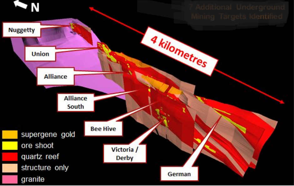
As the southernmost extension of the Bendigo goldfield, Maldon’s native gold 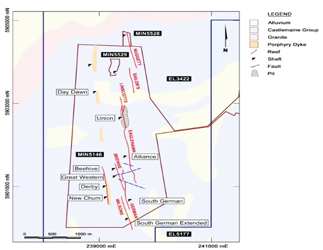 (in rock) is also located in reefs, which are recognisable, repeated rock formations with significant gold traces in their strata and strike (length and direction). The geological forces that formed them break and relocate the reefs, so that it takes skilled miners to understand the strata. Underground gold mines today are productive around 9 grams per tonne, and marginal at 5g/t. Open pit mines like Kalgoorlie are profitable at 2g/t because it’s cheaper to process their gold-bearing rock. Ours is very, very hard.
Maldon’s north-south reefs were arbitrarily named by their discoverers; winners’ names stuck. Thus the Beehive Mining Company’s (1859/60-1904) claimed its reef, and in 1882 the adjacent German reef spawned the North German, the Old German, and the South German mining companies. The Derby United Company (1867-1918) took over the Beehive and German Consolidated Company in 1897, closing it down in 1904. So the peaks for Maldon’s 100 tonnes of gold production were the 1860s, with lower peaks in the mid-1880s and late 1890s.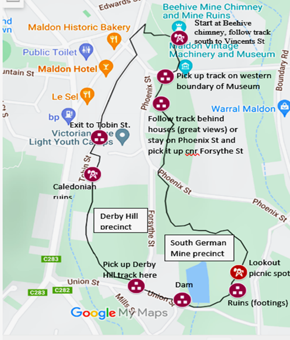
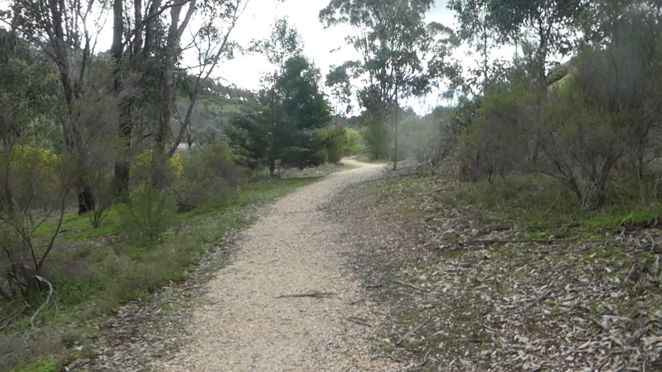
This 2.5km Maldon central mines Parks Victoria walk is based on a pamphlet by the Friends of the Tarrengower Diggings group.
It starts from Reef St, passing the fenced-in Beehive mine shaft on the town side and the footings for the steam-powered mining operations to the north.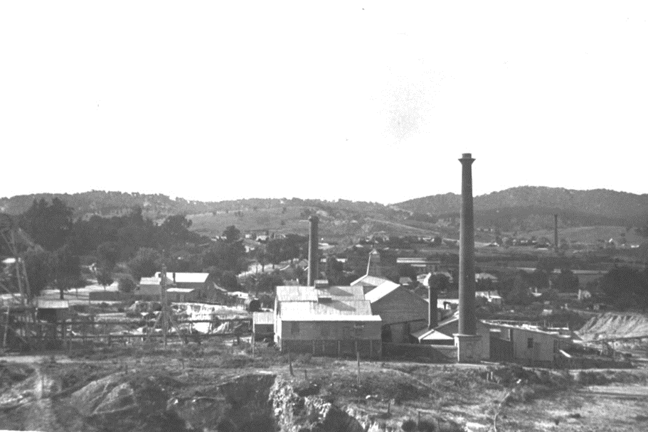
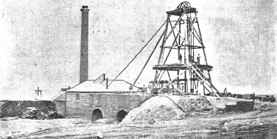
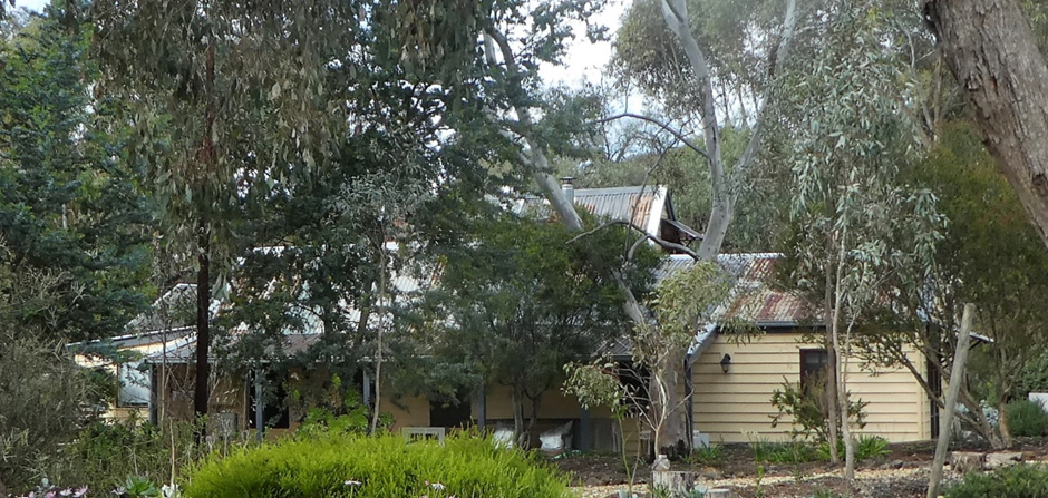
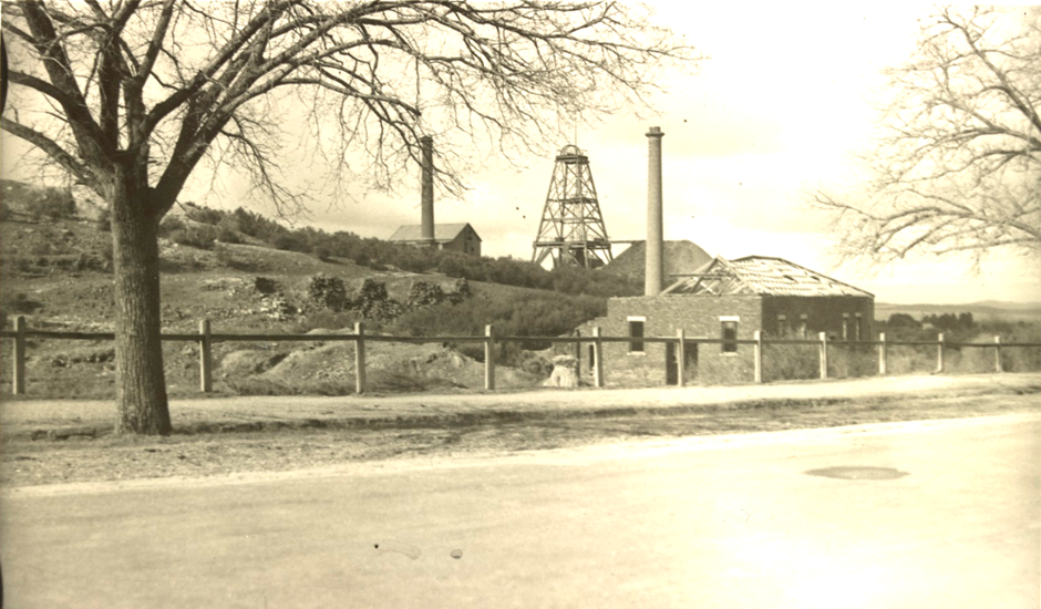
The picture shows the buildings for the New Beehive Gold Mining Company in 1886, with its distinctive chimney, originally 30m, rescued by townsfolk donations in 1918. In all, the mine produced six tonnes of gold. The landscape contains extensive mine debris (tailings). The left hand picture of the Beehive mine is looking north towards the Nuggetys, subject of another Wander. The further chimney may be the South Alliance mine.
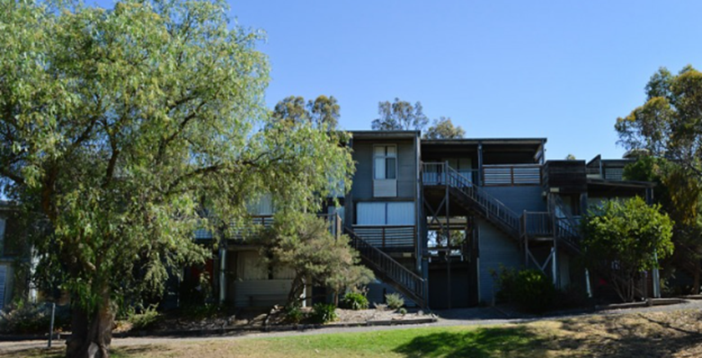
 Turning south, the trail follows the line of the Beehive reef, descending the hill past the Great Western Company’s mine on the right (west side). In the 1860s the Tiverton, Cymru, Alpha and Phoenix companies jostled for position on this reef, all claiming their patch. Great Western (picture) and Alpha ended up in court, disputing an underground reef, and when Alpha won they hired the Maldon brass band and turned on the beer at all Maldon’s public houses. Great Western finally triumphed, producing 800kg of the precious metal before merging with Cymru and later being absorbed by the Derby. During the 1880s, the Great Western Cymru substantially added to Maldon’s gold output.
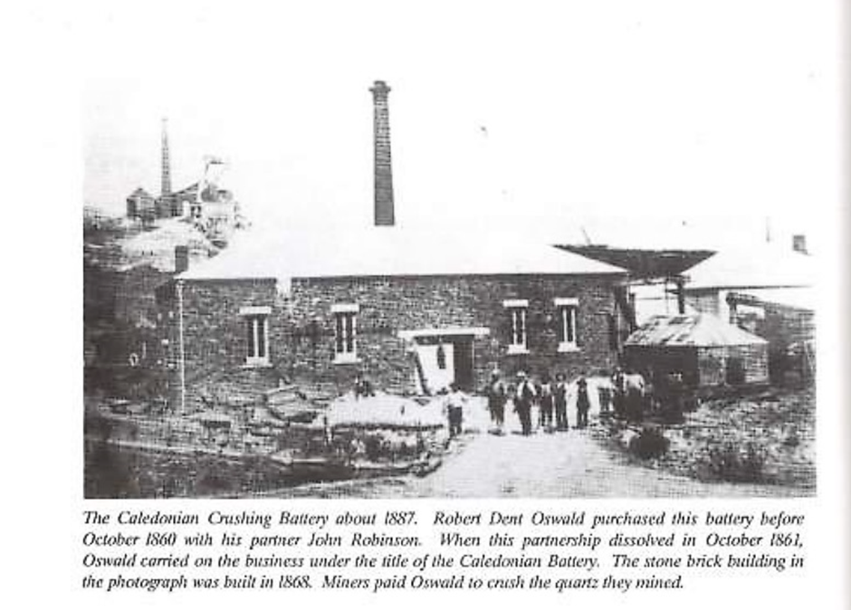
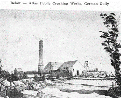 The Phoenix Quartz Crushing Mills (previously Atlas) operated from its location on the German Reef (Derby Hill) in 1863, together with the Phoenix Tavern, which were both owned by
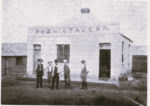 J. Rickard, along with the Phoenix Buildings around in Main St..
In May, 1877 there was a wedding (Hokin/Draper) at the hotel and W. Hokin’s wife gave birth there to their son on 7 August, 1878.
At Vincents Rd, the trail continues along the east fence of the  Maldon Vintage Machinery Museum; or for easier walking, use Phoenix Street. The next precinct, the South German mine, is reached by the Parks trail past the backs of houses, or by Phoenix St past the Derby Hill Youth Camp.
The accommodation was built in the 1970s to promote tourism for the town, and was operated for a time as an at-risk youth (Blue Light) camp. Its throughways are public domain, and Derby Hill’s now busy with school cycling camps.
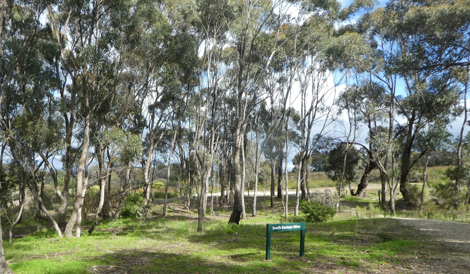 Arriving at the corner of Forsythe St., this is Parks Victoria’s South German mine precinct. The Parks trail emerges from behind the houses and joins up with the Phoenix/Forsythe spur about 50m. further on.
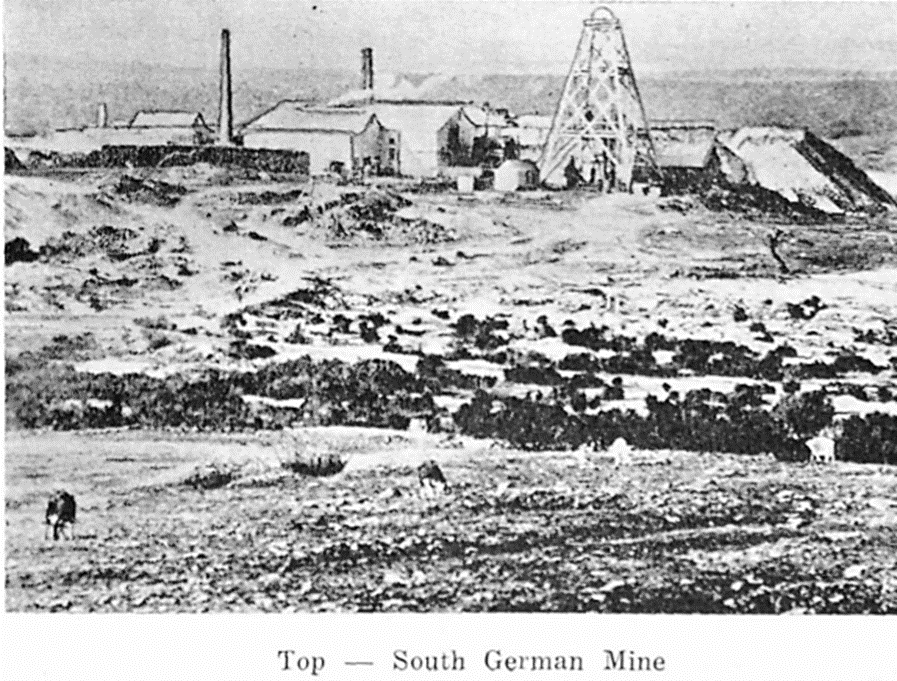
Maldon miners were innovative, taking up new technology and building efficiencies to extract more gold from the quartz. The South German was amongst the first to introduce cyaniding of its tailings (chemically treating crushed rock), doubling its gold output. In all, the company crushed 190,356 tonnes of gold-bearing rock for 5.37 tonnes of gold. It was also the deepest in Maldon, reaching over 600m. These are the then and now views, Forsythe St.
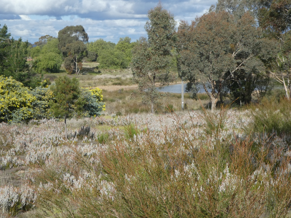
Other mines in the precinct were the German, the South German Extended, the Nelson, and Derby Extended. The South German mine left an unexpected legacy. As well as a beautiful spot to contemplate the world, that's the largest field of the white form of heath,Victoria's floral emblem (Epacris impressa) that you will see anywhere.
The Parks trail winds around the South German dam turning south to the picnic shelter next to the mine ruins. However, on the South German Road directly ahead (east), there’s the mine manager’s house and assaying office, built in 1866, and now much extended to accommodate a new generation of executives.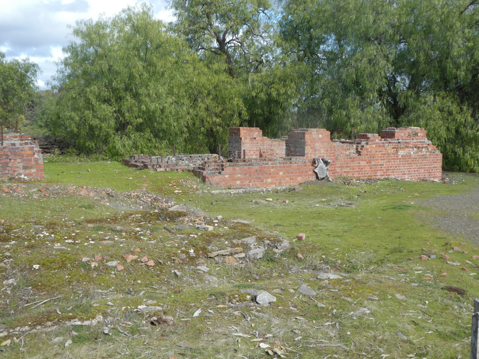
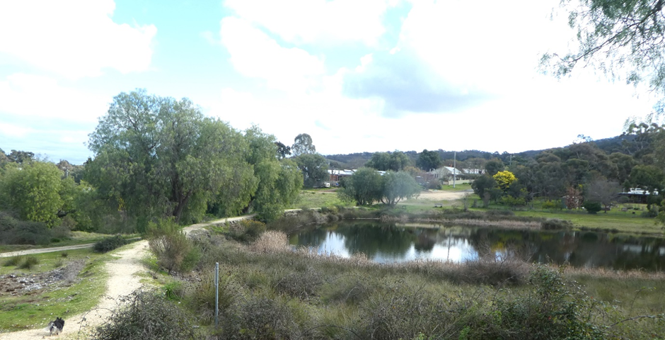
Return to the picnic area with its shelter overlooking the dam and wetlands, and Mt. Tarrengower. Adjacent are the ruins of the steam-driven winding and pumping machinery that ran the equipment down to the shaft. The shaft was situated downstream of the dam and long since filled in.
Following the dog, the trail returns back to Union St, where it can be picked up again at the corner of Forsythe St. for the remainder of the historic mine walk, the Derby Hill/Victoria Reef precinct.
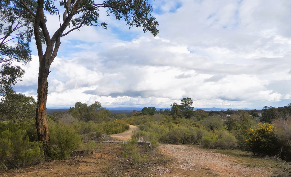
The Derby Hill precinct’s trail can be accessed as the high road, that is, north around the crown of the hill which has been repurposed also as a bike track for the children’s camp. It’s the better view, south to Daylesford and the distinctive Mt. Franklin with its cap of pine trees. Follow it around
 Branching off to the west and following the low road and Long Gully around to High St, you arrive at where once was the shallow North German mine (1882). It’s now no more than a depression and tailings heap, blended into the landscape. The Lady Darling and New Chum mines are also in this vicinity, as the New Chum was adjacent to the South German.
This menagerie was sorted in 1911, when a new mining company amalgamated a 55 hectare lease covering four full depth shafts: the Beehive, the Beehive and German (accessing the Beehive/German reefs for 5.38 tonnes of gold), and the Derby and the New Chum (for the Derby and Victoria reefs, about 9.3 tonnes). In 1925, a new New Chum company was established adjacent to the South German, paying 25 grams to the tonne.
As you emerge looking over Long Gully/ Tarrangower Creek/ High Street, the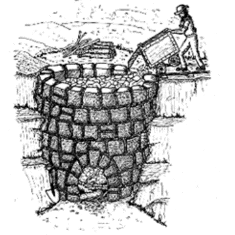
 Caledonian quartz burners appear. These egg-shaped ovens were stacked with layers of wood and quartz and burnt for days to clean the quartz (calcining) for crushing and retrieving gold.
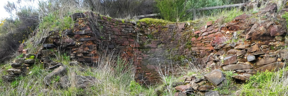
The original crushing works appeared here as Chrystal’s Battery in 1856, and was taken over by R,D, Oswald who lived opposite, at 9 High St. Over time, the Caledonian company built the ovens (on Swiper’s reef), dammed the creek and later the bridge, the remnants of which survive.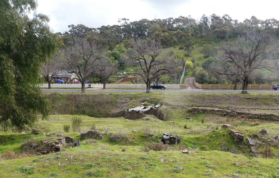
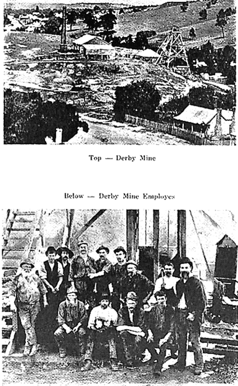
Continue walking a few metres along the gravel path which turns into the sealed bike track of the Derby Hill accommodation. Time has erased the Derby Company, 1865, which occupied the same site as the camp on Victoria reef. It was subsequently worked along its reefs in association with other mines, then merged with the Beehive to the north and lastly with the remainder of the mines in 1911. The Derby mine ore was transported to the Beehive mine courtesy of Mr. Oswald when he owned both, by means of a tramway, up Tobin St, past the Great Western, to the top of the Beehive/Reef St Hill. Weird, considering the Caledonian a few metres away. Nevertheless, Derby Hill produced well over a tonne and a half of gold.
If you follow the trail off down the hill to Tobin Street, not advisable if it’s slippery, there’s a walkway through to High St about 30m down the street from the trail exit. Or continue up through the camp to Phoenix/Reef Street, and then to Fairbank. A rest and rewarding libation is in order as you contemplate Maldon’s golden past.