A good drop
A good drop
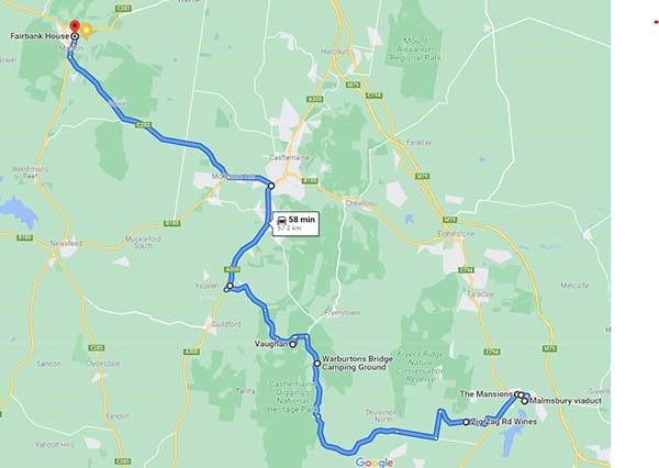
Total 120 km, 140 minutes driving, two maps for the wander.
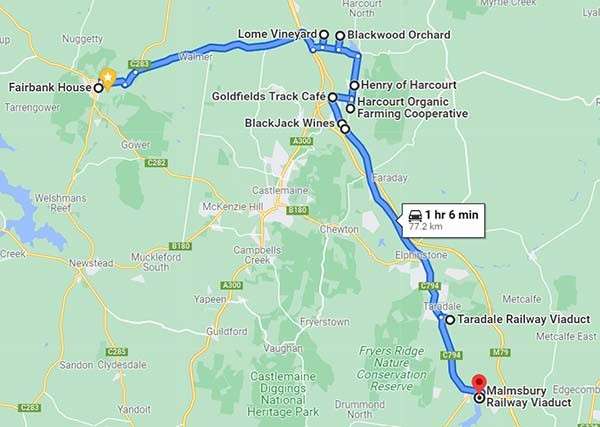
This is a true tale of discovery: a historic viaduct, two magnificent railway bridges, and delectables found in provedores, wineries and cideries of the Harcourt Valley and beyond. The railway viaducts span gullies from Melbourne to Bendigo. The Coliban water viaduct is also a marvel of 19th century engineering, taking water from the high rainfall area of the Macedon Ranges down to Bendigo and the northern plains.
To interweave through all the photo opportunities, there’s some pleasant places to pull in and enjoy the local fare, so to stretch the day, plan for Harcourt or Malmsbury for lunch.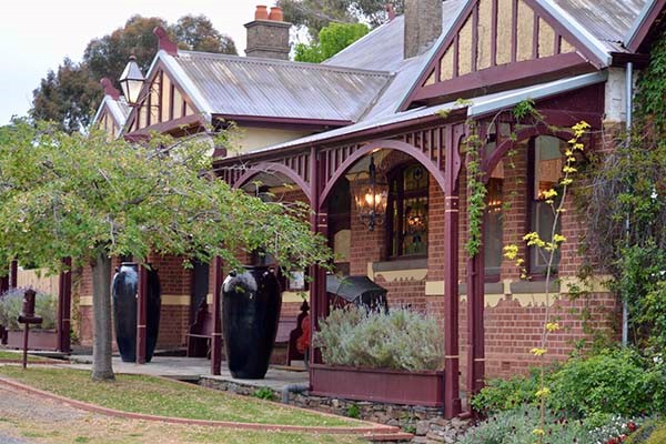
Starting off from Fairbank join Reef Street, driving north to the intersection of Allens Road just past the old Eaglehawk hotel, now a DYI wedding venue. It, and the Union Hill mine opposite, are the remnants of this northern suburb of Maldon, clustered around the Union Hill mine. Turn right at the intersection (east).on to Allan's Road.
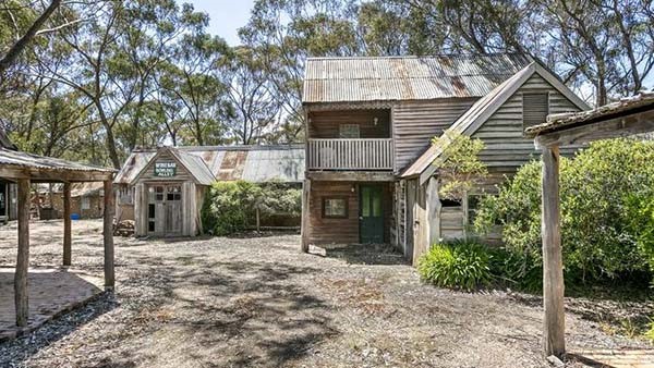
This takes you to the much older Porcupine locale, which predates (slightly) the finding of gold on Mount Tarrengower itself. The district catered to the diggers and supply oxen lorries from Melbourne and overlanders from Adelaide making their way on foot to the Victorian rushes. At the end of the road is Maldon's newest attraction, Porcupine Village, intermittently built from the 1970s to recreate the slab huts and tents of the rushes.
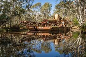
Turn left (north) on the Bendigo road. Coming into view on the left is a relic of George Haywood’s gold dredging business, the Porcupine Creek Dredging Company in the 1950s to 1980s. The original dredging area was further into the bush, now the site for Kaiser Mines' quartz crushing and gold refinery for the Union Hill and Alliance mines, the latter's ruins on Crown land opposite Fairbank. On the other (east) side of the Bendigo road is the Maldon Showgrounds, used for fairs, campdraft events and other horsey endeavours.
About 600m further on, bear right (east) on to Fogarty’s Gap Road. Go through some very pleasant countryside for about 15km, but watch the hill down from the Gap, because it goes straight into the Calder freeway. Cross the freeway to Harmony Way, a name change from Calder highway, and which commemorates Henry Harmony Nelson (1855-1919) of the Dja Dja Wurrung people. It's state highway C794.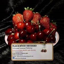
 Take the sharpish left turnoff after about 500m, turning east on McIvor Rd/Mount Alexander turnoff. North off this road is Bress Winery’s cellar door at Lome Vineyard, 59 Franklings Rd, Harcourt North, which offers an array of delectable vintages - https://bress.com.au/ winery.
Close by off McIvor Rd, (north again) you’ll find cherries and strawberries from October to April at Blackwood Orchards, 111 Chellews Rd. Harcourt North, although Fairbank guests simply look for the (very) fresh fruit in their fridge.
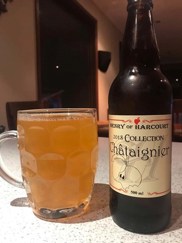 Continue along McIvor Rd and turn south into Reservoir Rd for another tasty drop. Henry of Harcourt, 219 Reservoir Rd, has a spectacular array of ciders – the family grows 43 of the 49 varieties of cider apple in Australia and ‘makes cider for grown-ups’ (or pink lady cider for the millennials). Open every day for your selection. http://henrycider.com/
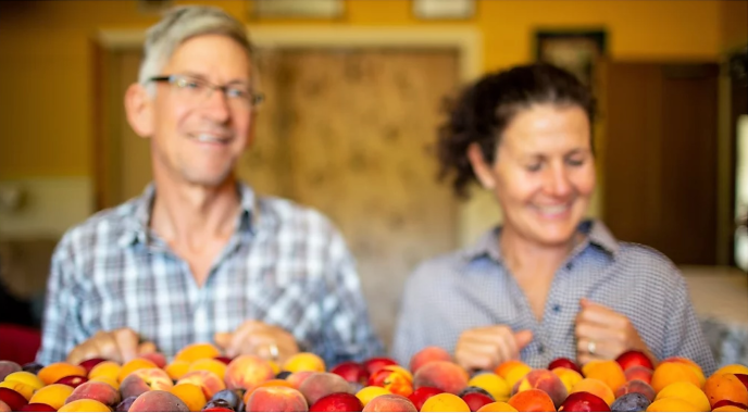
Further south, Reservoir Rd turns onto Danns Rd and runs right past Mount Alexander Fruit Gardens (no 69), now training the world to Grow Great Fruit. This is a certified organic farm, and they have fruit in season, fruit trees, a free newsletter on maintaining your fruit trees, and are well-known on the organic food scene in Melbourne. Pop in for a look and to purchase (also online at https://growgreatfruit.com/about-us/).
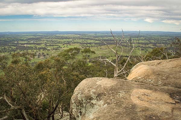 The granitic Palaeozoic rocks of Mount Alexander, or Lanjanuc of the Dja Dja Wurrung people, rises 746 m and is home to a koala colony who reside in their own regional park (http://parkweb.vic.gov.au/__data/assets/pdf_file/0020/315605/Park-note-Mt-Alexander-Regional-Park). To entertain them, there's a new Harcourt-level mountain bike park, La larr ba gauwa park which leads to the trails (https://lalarrbagauwa.harcourt.vic.au). In 1836 Major Mitchell (re)named the mountain, first as Mount Byng, changing it to Alexander the Great as a nod to Mount Macedon in the south, and he also named the nearby river Campaspe after Alexander's lover. When central Victorian gold was discovered in 1851 by women from the Ravenswood Run (North Harcourt), the mountains were the route for tens of thousands of diggers in the 1860s Now, the two mountaina are still a drawcard for sports, leisurly walks, and views, like Lang's lookout.
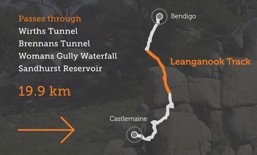
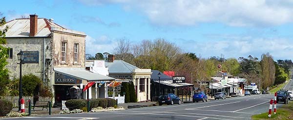
Back at the Reservoir Rd turnoff, Picnic Gully Road leads to the start of the mountain bike trails and left (west) into Market Street takes you into Harcourt. Given its position on the Ballarat to Bendigo Goldfields track, Harcourt's mountain bike watering hole is the Goldfields Track Café at 23 High St, for of-the-minute information, and for vehicles and support gear, Bike Trails carpark, 60 High Street.
 The Australian Natives Association hall (for anyone born in Australia) in High St to the south of the cafe is home to the local museum showcasing the food and wine history of the area. Usually open during the weekend, swing by and see. Check up at http://harcourt.vic.au/ana-hall.
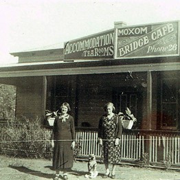
The Produce and general store at 115 Harmony Way (state highway C794) has beautiful food, delightful people. Picture – bit before Annette’s time. Book lunch at https://www.harcourtproduce.com/
 Continuing south along Harmony Way the choice is yours, with vineyards sharing many trophies and awards. First there’s Blackjack Wines, the home of the big red, with cellar door open weekends during the season. Then Harcourt Valley Wines’ (next) door is open Sundays. They have both whites and reds, plus pale ale, ginger and fruit beer.s . Flanking Harmony Way on the west is the Coliban water channel walk, which follows the engineering masterpiece all the way to Bendigo (more on this when you arrive at Malmsbury).
Six kilometres from Harcourt is Faraday and the turnoff for southern access to the mountain and more magnificant
 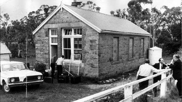 views over Sutton Grange. Faraday became notorious in October 1972 for a school kidnapping, when two masked men broke in and kidnapped a 20-year old teacher, Mary Gibbs, and her six pupils, demanding $1,000.000 ransom from the Victorian Government. The kidnappers locked their victims into the back of a van in the late afternoon and drove to Lancefield. Later that night, they told the teacher they were going to collect the ransom. The teacher managed to kick out a door panel around dawn and escaped with her charges. They were found by some hunters about 8am, 15 hours after the kidnapping. The perpetrators were caught and convicted but one, John Eastwood, escaped and repeated his crime in Gippsland. Eastwood said that he got the idea from a scene in a Clint Eastwood movie, Dirty Harry and the Faraday event became the basis of the 1985 movie Fortress, directed by Arch Nicholson starring Rachel Ward. The 1869 Faraday school was eventually sold and set up with other residences for (then) tourist accommodation.
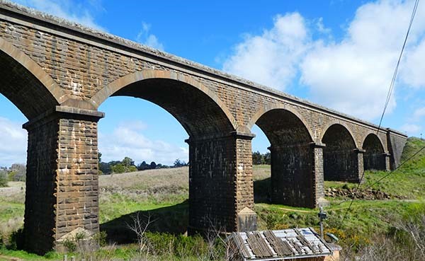
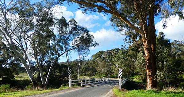
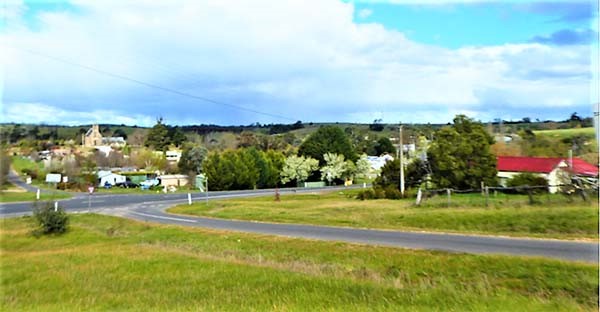 Fifteen minutes south of Harcourt on the old Calder highway/State highway C794 lies Taradale, placed neatly at the bottom of the valley. Turn left (east) into de la Beche St with its delightful linear mineral springs park along Back Creek and there’s the first of the Big Drop bridges. Made of wrought iron and stone and of box construction, the Taradale viaduct is 252m long and 33m high. Those statistics look spectacular from underneath . The design specifications for this and other (ori
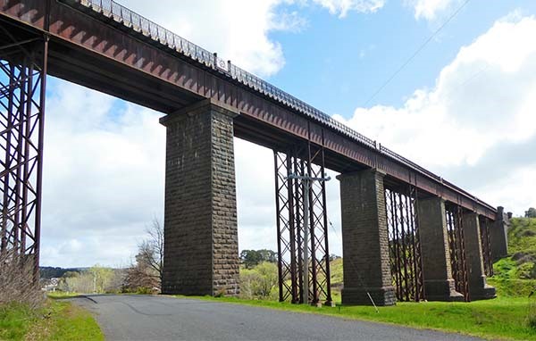 ginally) private railways were set by the Surveyor-General and the grandeur of the design is only enhanced by the knowledge that the
 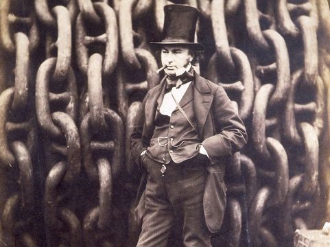 one and only Isambard Kingdom Brunel supervised the bridge’s ironwork made by the Rowland Brotherhood of Wiltshire, England. The reinforcing struts were added in the 1920s when larger and heavier trains became the norm. Coming down to earth, W. Urquhart laid the foundation stone in September, 1861 and it was completed in 1862.
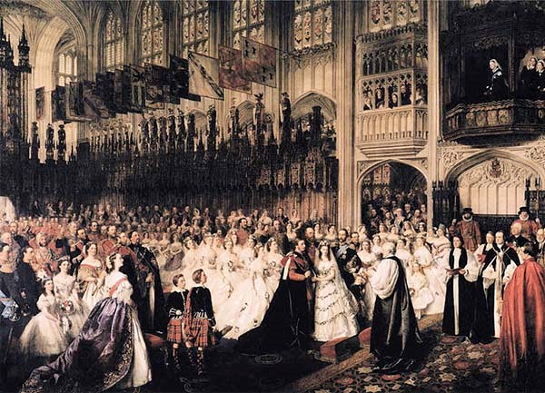 For a pitstop to toast the accomplishments of the past in ginger or fruit beer/gin, continue under the bridge to the renovated (car) park. This is where the marriage of Queen Victoria’s eldest son, King Edward to Queen Alexandra in 1863 was celebrated by the planting of two oaks some two months after the event - no television in 1862. Edward’s oak lasted until 2013 and both were replaced that year. The two monuments look suspiciously like left-over cemetery headstones, and the king and queen reference is interesting, as it predates Queen Victoria’s demise by some 38 years. Brunel wouldn’t have liked that sloppiness. But it was a big wedding, nonetheless.
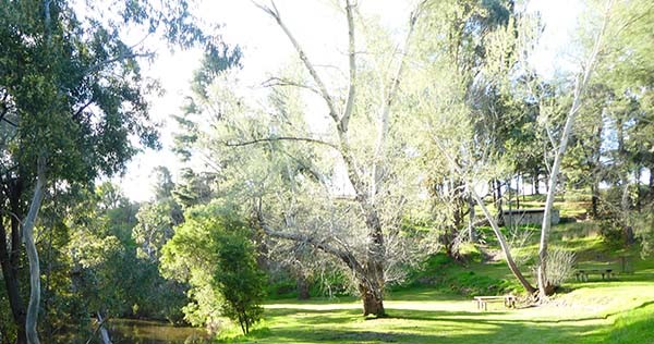
 For the second Big Drop bridge, continue down the old Calder/C794 to Malmsbury, turning south around the Malmsbury Gardens and lake at Ellsmere St. To get a better view, park at the back of the gardens as the road is not easily navigable down and under the bridge. It’s an opportunity lost, as with its Romanesque design, the bridge is the equal to Taradale’s in its impact.
 It’s a magnificent brick and stone arched bridge with the slowly moving Coliban River adding to the quintessential country scene. The bridge is over 100m long with five 18m spans standing about 25 metres above the river. This was the first bridge of the two, planned by the fading force of the Melbourne, Mount Alexander and Murray River Railway, a private consortium which was taken over by the colonial government. Similar to Taradale, the new Victorian Railways finished the job in a year – the foundation stone laid on 25 October 1850 and the bridge completed on 24 October 1860. Old V/Line engineers didn’t waste time back then.
Winding under one of the arches is the Coliban river, the source of the Bendigo water supply that serves Maldon. The Coliban Water Works was 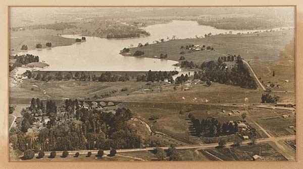 designed in 1858 - 1863 by our own Brunel – an Irish born engineer, Joseph Brady (http://www.coliban.com.au/site/root/about/documents/CW_JBrady_collated-Web.pdf). Coliban Water today continues to use the channels, tunnels and engineering aplomb that feeds water from the Great Dividing Range to the northern plains.
 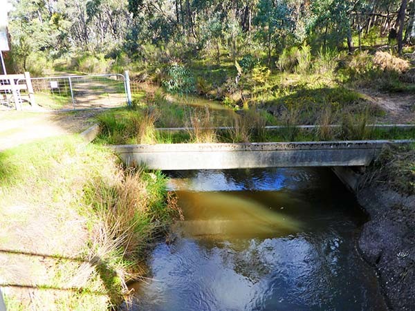 From Malmsbury, the system comprised the reservoir, 70 km of channel to travel a linear 45 km, and unique water treatment plants of sand and cisterns. Water first flowed along its viaducts in 1877. Two more reservoirs were constructed south of Malmsbury, the Lauriston reservoir with its well-landscaped picnic area and the largest, the Upper Coliban reservoir (1903). These reservoirs are the subject of another half-day wander.
Watering holes in Maksbury are The Stables (pizzas), Ellesmere St, http://www.the-stables.com.au/; Merchants of Malmsbury (cafe) and the Malmsbury Hotel. There's also a bakery that has a large following.
Emerging from the Malmsbury viaduct on to the main road, retrace your route back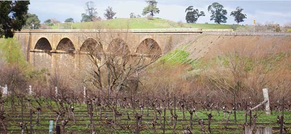 over the Coliban River, past Birthday Villa winery named after the Birthday Mine, where gold was discovered on Queen Victoria’s birthday. Overlooking a certain bridge, it's open by appointment, and their wine is made in Musk: https://www.birthdayvilla.com.au/
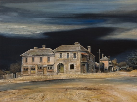
Turn left (south) on the Daylesford/Malms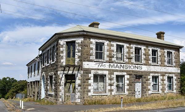 bury road, C316, past The Mansions, originally a hotel from the 1850s which staggered through a series of indignities to dereliction. Shame no one’s taken the plunge and acquired it. That’s one busy corner, Someone took pity on it: Kenneth Jack, 1967
 Over the railway crossing and its cute station hiding under layers of modernity, keep south for a couple of kms then turn right (west) on to Zig Zag Road to check out Churchill’s Zig Zag Wines and cellar door, usually open end of week (https://www.zigzagwines.com.au/). Next time book in at tel 5423 9390 and add in a picnic box.
Continue along the scenic route (west) to Taradale Road, turn left (south) and at the intersection of Vaughan Springs road, turn west (zigzag!). This verdant slice of central Victoria: Drummond, Glenluce, Spring Hill, Glenlyon and Denver is home to show gardens, wineries, farmers and just about every arts and craftsperson imaginable. Plus the top garden designer.
 Now named Drummond-Vaughan. the roa
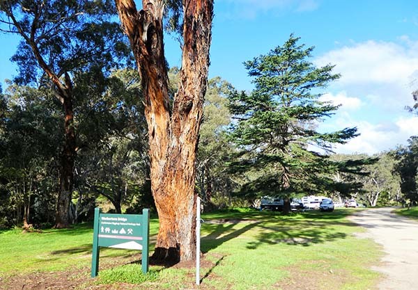 d wanders into the Castlemaine Diggings National Park and northwards through the bush to Warburton Bridge, which is a very nice old bridge over the Loddon river, but not exactly awe-inspiring. After all, it wasn’t meant for trains, and the water goes underneath There is a popular campsite upriver, though.
Downriver are the Glenluce Mineral Springs and Central Springs, pristine springs associated with the Loddon, but which are difficult to access. They’re off Glenluce Springs Road, about 1.5km past Warburton Bridge.
At the Vaughan-Chewton Road intersection, turn left (west) and visit Vaughan’s springs, using any empty bottles from toasting the marriage of whomever at Taradale to fill up. Vaughan Springs is a mini-Hepburn with some precipitous geology, and much regarded by 19th century Castlemainians for a Sunday picnic, and Taking the Waters. You may as well follow tradition - many still do. It's on the Faraday half-day wander in this series.
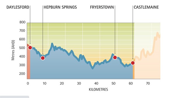 Remember the Goldfields Track from way back at Harcourt? Vaughan Springs Is also a way stop on the central section, the Dry Diggings Track (http://www.goldfieldstrack.com.au/) for later investigation: walking, or mountain bike. As the figure shows, it’s a vertical zig-zag, with Mount Alexander in tasteful peach tones at the apex - which that part of the track doesn't access.
Returning back to Vaughan Springs road, continue through town to the Midland Highway, turning right (north} to Campbell’s Creek, the site of Chinese market gardens back in the day. Cross the Maldon-Castlemaine rail and turn right at Elizabeth St/Pyrenees Highway for Maldon.
Moseying back into town as the sun sinks behind Tarrengower, your own mountain, go out on the front verandah at Fairbank with a Good Drop and watch the dying rays of the sun on the food bowl that’s Mount Alexander. And ponder why Major Mitchell called it after Alexander, and why the Campaspe lies at its foot. Ask Tiepolo. Or the Shire of Campaspe at Echuca.